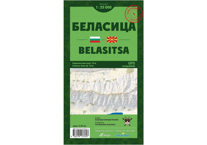
Hiking map of Belasitsa
Explore the wild forests of the Bulgarian part of Belasitsa and visit the highest peaks, Radomir and Kongur, with a convenient pocket map from the Free Mountains Association.
View full description
Оrder by Phone: + 359 882 743 923
![]() We ship to all EU countries
Delivery time between 5 - 7 business days
(See shipping rates)
We ship to all EU countries
Delivery time between 5 - 7 business days
(See shipping rates)
![]() 2 year warranty
on this product
(See conditions)
2 year warranty
on this product
(See conditions)
![]() 30 days
Returns accepted
(see conditions)
30 days
Returns accepted
(see conditions)
![]() Pick up from our store
Monday - Saturday: 10:00 am - 7:00 pm
(see our location)
Pick up from our store
Monday - Saturday: 10:00 am - 7:00 pm
(see our location)
Explore the wild forests of the Bulgarian part of Belasitsa and visit the highest peaks, Radomir and Kongur, with a convenient pocket map from the Free Mountains Association.
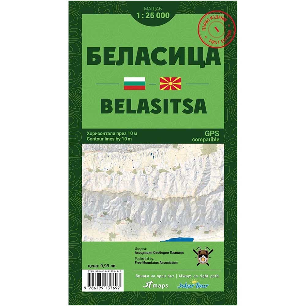
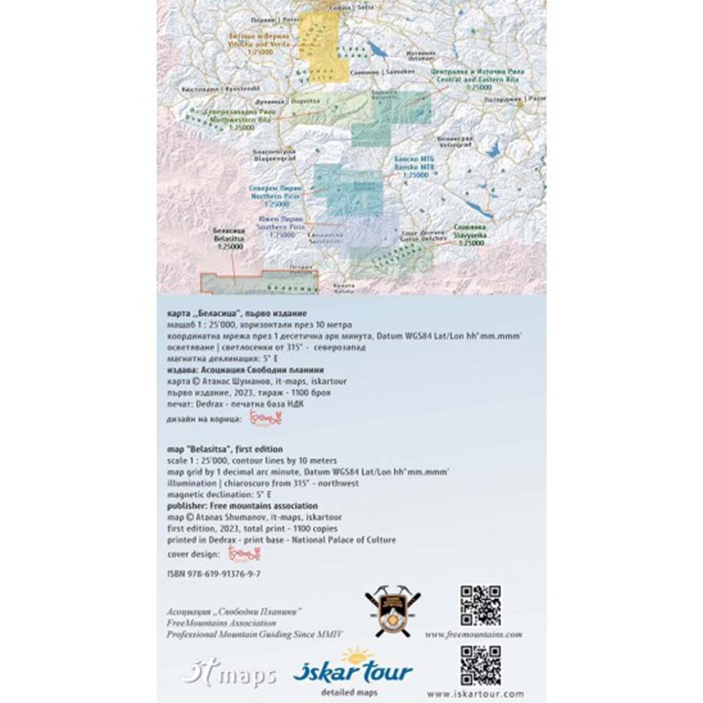
We present to you a pocket-sized map of Belasitsa at a scale of 1:25,000 with contour lines at 10-meter intervals. This edition of the map includes numerous details of the terrain and topography.
The Belasitsa map highlights the boundaries of all protected areas within its coverage, marked hiking trails, mountain huts, shelters, information centers, ski resort facilities, and all details corresponding to the map scale.
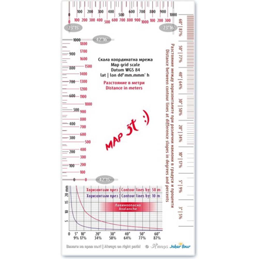
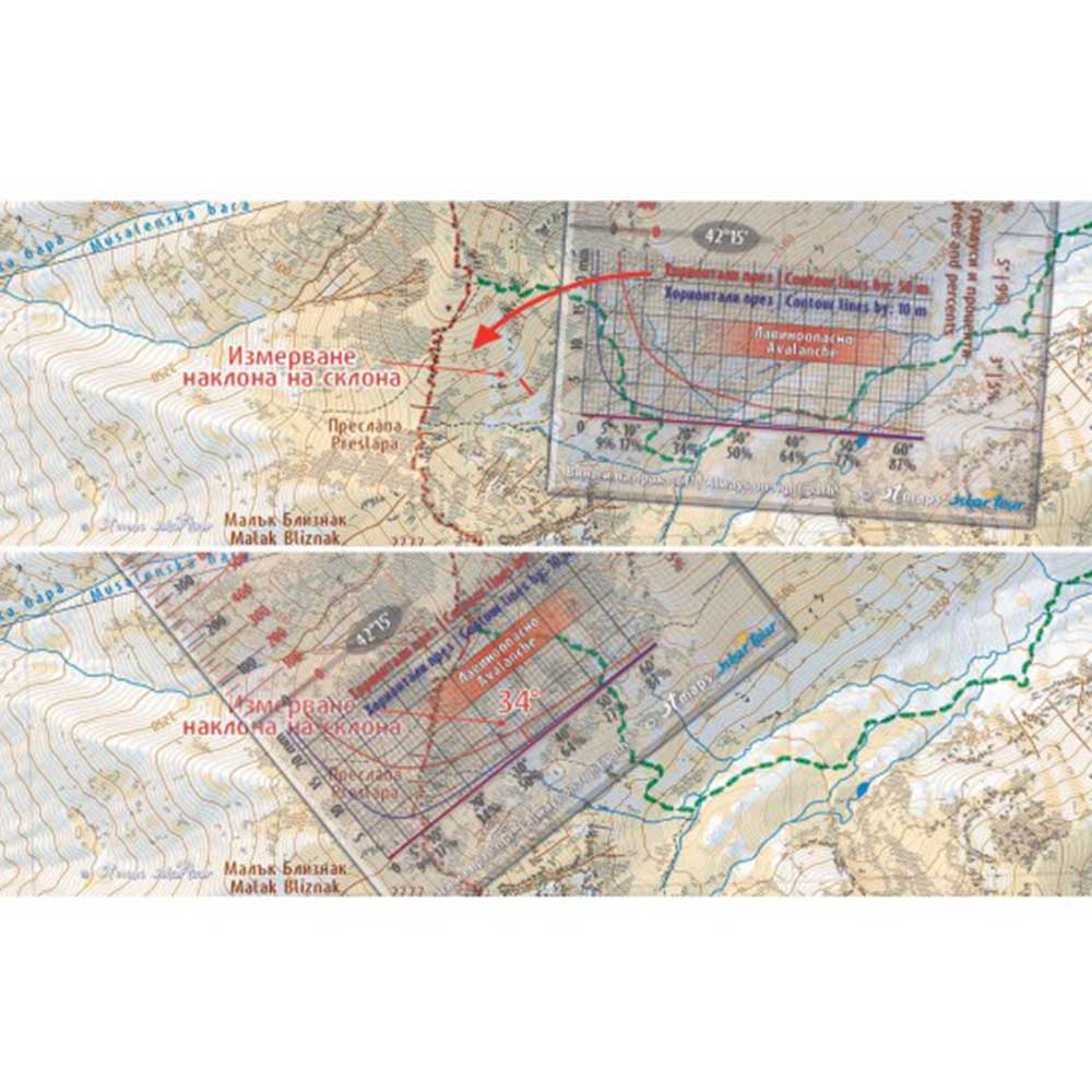
The set includes a scale ruler made of transparent material with a grid for measuring distances—the scale is marked in decimal arc minutes. It also features a scale for measuring slope angles. The printed map is housed in a 100% transparent PVC pocket, and the new design includes an opening at the top, short side of the pocket.
- Printed pocket-sized tourist map of Belasitsa
- Detailed information on popular locations such as Radomir Peak, Kongur Peak, and others
- Includes a 100% transparent PVC pocket
- Includes a scale ruler with a grid for distance measurement
- GPS compatible
- Publisher: Free Mountains Association
- Scale: 1:25,000
- Contour lines at 10-meter intervals
- Dimensions folded: 12 x 22 cm
- Dimensions unfolded: 100 x 70 cm